
provide a unified, easy‑to‑read visual layer across all country and regional profiles. They support the Factbook’s mission to deliver clear, authoritative geographic and geopolitical information through consistent cartographic design and up‑to‑date boundary data.
What the 2020 Maps Represent
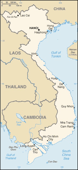
- Country Maps — Each nation includes a political map showing borders, major cities, and neighboring states. These maps help readers situate countries geographically and understand regional relationships.
- Regional Maps — Broader regional maps (e.g., Africa, Europe, Asia) illustrate continental divisions, major landforms, and geopolitical groupings.
- Thematic Maps — Some editions include maps highlighting climate zones, natural hazards, or environmental features, supporting the Factbook’s sections on geography and environment.
- World Overview Maps — Global maps show oceans, continents, and major physical features, aligning with the Factbook’s explanations of Earth’s land–water distribution and ocean basins.
🌍 Purpose of the Maps
- Visual Context — Maps help readers interpret country data—population, economy, environment—within a spatial framework.
- Geopolitical Insight — Borders, disputed areas, and strategic locations are easier to understand visually.
- Educational Use — Students, journalists, and travelers rely on these maps for quick orientation and comparative study.
World Factbook Maps 2020